

The beginning of this week is bringing spring-like weather to Serbia, but the mornings will be cold, in the valleys with fog.
Recommended

Zaboravljena žitarica koju morate vratiti na trpezu: Čuva zdravlje creva i produžava osećaj sitosti
Udaje se Mina Vrbaški! Ulovila starijeg, planira svadbu i bebu: "Blokirala sam Pink, vreme je da se skrasim"
It will be sunny during daytime.
Maximum temperatures will be up to 22°C today, and up to 24°C tomorrow.
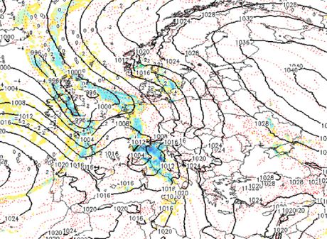
Clouds are expected to increase on Wednesday. A cyclone from the central Mediterranean will get stronger, pronounced southerly currents are expected at its front, so a very warm air mass will arrive from the north of Africa, with the maximum temperature up to 25 degrees.
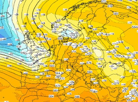
The strengthening of the southeasterly wind is expected, and in the Kosava region, the southeasterly wind will occasionally produce gale force gusts.
A noticeable drop in air pressure is expected and this will introduce a more pronounced change in the weather.
Apart from the very warm air mass, particles of sand from the Sahara will also arrive from the north of Africa. These particles will be lifted high into the atmosphere and as they cross the Mediterranean, the formation of clouds and precipitation is expected.
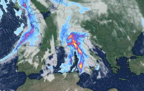
This cloud system will move over Serbia on Wednesday evening and Thursday night and bring "dirty rain" and showers with particles of desert sand from the Sahara. This phenomenon is best visible after the rain stops, and mostly on vehicles.
This precipitation will be transient and will stop by the next morning.
On Thursday afternoon and evening, a cold front is expected to break through from the northwest, with a strong northwesterly wind and rain, with a cooling, and a strong northwesterly current that will clear the atmosphere of the particles of the Sahara desert sand.
(Telegraf.rs)
news_in_focus
Ogromna srpska zastava na nebu iznad Floride: "Sa 1.000 metara čuo sam decu kako vrište i raduju se"
Abramovičev Boeing 787 od 350 miliona dolara već četiri godine parkiran u Dubaiju: SAD izdale nalog za zaplenu
Braća od zapuštenog dvorišta napravila malu Grčku: Uložili 12.000 dolara, a rezultat je oduševio milione
Poginula žena čuvenog pevača Mirka Ćajića: Auto je noćas pokosio kod Orlovače
"Vladan Milojević je Zvezdin spasitelj i treba da mu naprave statuu na Marakani, Dekijev odlazak me boli"
Video: Zapaljeni automobili na Novom Beogradu
Telegraf.rs zadržava sva prava nad sadržajem. Za preuzimanje sadržaja pogledajte uputstva na stranici Uslovi korišćenja.
Comments
Web stories

STIŽE PROMENA KOJU MNOGI MRZE! Uskoro pomeramo kazaljke na satu: Evo kog tačno datuma dobijamo sat sna više
IMA MRTVIH U NEREDIMA U FRANCUSKOJ! Pala prva žrtva, oglasio se potpredsednik Amerike, evo koga je optužio za NEZAPAMĆENO NASILJE (FOTO, VIDEO)
Odakle su oni koji su iz SA i KA: Za ove i još dve registarske oznake retko ko pogodi koji grad predstavljaju
